
The Lewis and Clark Expedition: Mapping the Louisiana Territory (1804-1806)
From 1804 to 1806, the Lewis and Clark Expedition, officially known as the Corps of Discovery, traversed the vast expanse of the Louisiana Territory. Commissioned by President Thomas Jefferson, this monumental journey aimed to explore the newly acquired lands following the Louisiana Purchase of 1803. The expedition not only mapped uncharted territories but also documented the diverse cultures and ecosystems encountered along the way.
Jefferson’s Vision and the Expedition's Goals
The impetus for the expedition came from Thomas Jefferson's vision of westward expansion. After the United States acquired the Louisiana Territory from France, Jefferson recognized the need to understand the geography, resources, and inhabitants of this vast land. He sought to establish trade routes and assert American presence in the region. Jefferson's instructions to Meriwether Lewis and William Clark were clear: explore the land, document its resources, and establish relations with Native American tribes [1][4].
Jefferson's interest in the scientific aspects of the expedition was also significant. He instructed Lewis to collect specimens of plants, animals, and minerals, as well as to document the geography and climate of the areas they traversed. This scientific inquiry was rooted in the Enlightenment ideals of observation and classification, reflecting Jefferson's belief in the importance of knowledge for the advancement of the nation [1][3].
The Corps of Discovery: Key Members and Their Roles
The Corps of Discovery consisted of about 45 members, including soldiers, frontiersmen, and interpreters. Among them were Meriwether Lewis and William Clark, who were tasked with leading the expedition. Lewis, a former army captain and Jefferson's personal secretary, was responsible for much of the scientific documentation. Clark, a skilled cartographer and military officer, played a crucial role in mapping the journey and maintaining order among the men [3][5].
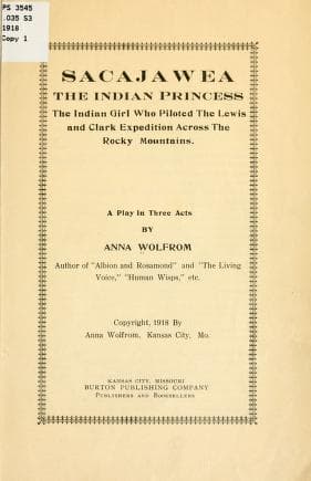
Two notable figures in the expedition were Sacagawea and York. Sacagawea, a Shoshone woman, served as an interpreter and guide. Her knowledge of the land and languages proved invaluable, especially when the Corps encountered various Native American tribes. Sacagawea’s presence also helped to foster peaceful relations, as she traveled with her infant son, which signaled to tribes that the expedition was not a hostile force [1][5].
York, an enslaved African American man who accompanied Clark, was another essential member of the team. His contributions included hunting, scouting, and serving as a bridge between the Corps and Native American tribes. Although he faced significant challenges due to his status as an enslaved person, York's role in the expedition highlighted the complexities of race and identity in early American history [4][5].
The Journey Begins: Departing from St. Louis in 1804
The expedition officially began on May 14, 1804, when the Corps departed from St. Louis, Missouri. The journey unfolded in several stages, with the group navigating the Missouri River, which served as a primary route into the heart of the continent. The Corps faced numerous challenges, including treacherous waters, harsh weather, and encounters with wildlife [1][3].
As they traveled upriver, the Corps documented their observations in journals. These journals would later become a vital historical resource, providing insights into the expedition's experiences and the lands they traversed. Lewis and Clark meticulously recorded their encounters with various Native American tribes, including the Otoe, Omaha, and Lakota, noting their customs, languages, and trade practices [2][4].
Mapping the Unknown: The Expedition's Scientific Contributions
One of the expedition's primary objectives was to create accurate maps of the Louisiana Territory. The Corps utilized various surveying techniques to chart their route, including celestial navigation and triangulation. Clark, in particular, excelled in cartography, producing maps that would be used for decades to come [3][5].
The journals of Lewis and Clark also contained detailed descriptions of the flora and fauna encountered during the journey. They documented over 120 species of plants and animals that had not been previously recorded by European scientists. This scientific documentation contributed to the broader understanding of North American ecosystems and laid the groundwork for future exploration and study [2][4].
Encounters with Native American Tribes
Throughout their journey, the Corps of Discovery interacted with numerous Native American tribes. These encounters were often marked by curiosity and mutual interest, although tensions occasionally arose. The Corps relied on the goodwill of these tribes for food, shelter, and guidance, which underscored the importance of diplomacy in their mission [1][3].
One of the most significant encounters occurred with the Mandan tribe in present-day North Dakota. The Corps spent the winter of 1804-1805 among the Mandan, where they established a fort known as Fort Mandan. This period allowed the expedition to rest, resupply, and prepare for the next leg of their journey. The Mandan provided valuable assistance, sharing knowledge about the land and resources [4][5].
Sacagawea's role became particularly crucial during this time. She was able to communicate with the Mandan and later helped the Corps locate her native Shoshone tribe, which was essential for securing horses needed to cross the Rocky Mountains [1][3].
Crossing the Rocky Mountains: Challenges and Triumphs
In the spring of 1805, the Corps resumed their journey, facing the daunting task of crossing the Rocky Mountains. The expedition's route through the mountains was fraught with difficulty, including steep terrain, unpredictable weather, and dwindling supplies. The Corps relied on Sacagawea's knowledge of the land to navigate the treacherous paths [1][4].
The expedition reached the Continental Divide in late August 1805. The challenges of this leg of the journey tested the endurance and resolve of the Corps. They faced starvation and exhaustion, but their determination to complete the mission drove them onward. The successful crossing of the Rockies marked a significant achievement for the expedition and opened the way to the Pacific Ocean [3][5].
Reaching the Pacific: The Columbia River and Beyond
After crossing the Rockies, the Corps descended into the valleys of the Columbia River. In November 1805, they reached the Pacific Ocean, fulfilling one of Jefferson's primary goals for the expedition. The sight of the ocean was a moment of triumph for the Corps, marking the culmination of their arduous journey [1][4].
During their time at the Pacific, the Corps established a winter camp known as Fort Clatsop, named after the local Clatsop tribe. The winter of 1805-1806 was challenging, with heavy rains and limited food supplies. Despite these hardships, the Corps continued to document their observations and experiences, adding to the wealth of knowledge gathered during the expedition [2][5].
The Return Journey: Challenges and Discoveries
The return journey began in March 1806, with the Corps retracing their steps back to St. Louis. The expedition faced new challenges, including encounters with hostile tribes and the need to navigate the same difficult terrain they had crossed before. However, they also made new discoveries, including additional species of plants and animals [1][3].
Sacagawea played a vital role in the return journey as well, helping the Corps navigate and communicate with tribes they encountered along the way. Her contributions were essential in ensuring the safety and success of the expedition [4][5].
The Legacy of the Lewis and Clark Expedition
The Lewis and Clark Expedition concluded in September 1806, when the Corps returned to St. Louis. Their journey had profound implications for the United States. The maps and scientific data collected during the expedition provided a foundation for future exploration and settlement of the West. The expedition also fostered a greater understanding of the diverse cultures and ecosystems present in the Louisiana Territory [1][2].
The journals of Lewis and Clark became historical treasures, offering insights into early American exploration and the interactions between European Americans and Native American tribes. These documents are preserved in various federal collections, including the Library of Congress and the National Archives, ensuring that the legacy of the expedition endures [2][3].
The Role of Federal Collections in Preserving History
Today, the journals and artifacts from the Lewis and Clark Expedition are housed in several federal collections. The Library of Congress holds a significant collection of the expedition's journals, which have been digitized for public access. These documents provide a firsthand account of the expedition's experiences and are invaluable for historians and researchers [2].
The National Archives also preserves maps and documents related to the expedition, highlighting the importance of federal collections in maintaining the historical record. The Smithsonian Institution features exhibits that showcase artifacts from the journey, further enriching public understanding of this pivotal moment in American history [3][5].
Conclusion: The Enduring Impact of the Corps of Discovery
The Lewis and Clark Expedition remains a defining moment in American history. The Corps of Discovery's journey across the Louisiana Territory not only mapped uncharted lands but also fostered relationships with Native American tribes and contributed to the scientific knowledge of the time. The expedition's legacy continues to resonate, reminding us of the complexities of exploration, cultural exchange, and the pursuit of knowledge.
As we reflect on this monumental journey, it is essential to recognize the contributions of all members of the Corps, particularly Sacagawea and York, whose roles were crucial in navigating the challenges of the expedition. The Lewis and Clark Expedition serves as a testament to the spirit of exploration and the quest for understanding that has shaped the United States.